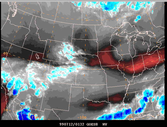
SPC Satellite Picture Example:
Moisture Channel Image
Satellite imagery of all kinds is very important to severe thunderstorm and tornado forecasting. Moisture channel (water vapor) imagery like this looks strange to the untrained eye; but it can provide a lot of useful insight into what is happening in the upper troposphere. Red to black areas denote dryness in upper levels; while white to blue means moist. Severe storms often (but not always!) develop near demarcations between dry and moist air aloft -- assuming other factors (like low level moisture, shear, lift and instability) are favorable.