Forecast Tools
Upper Air | Soundings | Sounding Climo | Lightning Climo | Mesoanalysis | HRRR | HREF | SREF | SREF-Plumes | FireWX Compmaps | Compmaps
| Upper Air Maps |
|---|

|
Maps and derived fields based on twice daily (00 and 12 UTC) radiosonde data over the continental U.S.
|
| Observed Sounding Analysis |
|---|

|
Skew-T charts for all observed soundings across the United States.
Many experimental forecast tools and parameters are shown.
|
| Sounding Climatology |
|---|

|
A CONUS-wide observed sounding climatology, featuring over 60 parameters, is available for 00, 12, and ALL UTC soundings.
Observed values from the most recent 00 and 12 UTC soundings may be overlaid.
|
| Lightning Climatology |
|---|

|
Lightning climatology across the contiguous United States (CONUS).
|
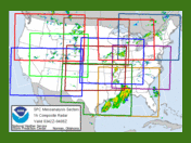
| Mesoanalysis Graphics |
|---|
|
Nine fixed regional sectors and a national sector provide hourly gridded mesoanalysis graphics across the CONUS.
|
| High Resolution Rapid Refresh (HRRR) |
|---|

|
Hourly HRRR model graphics are provided for nine fixed regional sectors and a national sector.
|
| High Resolution Ensemble Forecast version 2 (HREFv2) |
|---|

|
The SPC HREF Page contains advanced guidance for many weather hazards, with tabs for synoptic, severe, winter, fire, precipitation, and CAM storm attributes, that can be displayed over a CONUS domain or one of nine regional sectors. The HREF page replaces the previous SPC SSEO page.
|
| Short-Range Ensemble Forecast (SREF) |
|---|

|
The SPC Short-Range Ensemble Forecast (SREF) is constructed by post-processing all 21 members of the NCEP SREF plus the 3-hour time lagged, operational NAM (for a total of 22 members) each 6 hours (03, 09, 15, and 21 UTC).
|
| Short-Range Ensemble Plumes |
|---|

|
The SPC SREF Plumes Page displays point forecasts for each of the 21 members of the NCEP Short-Range Ensemble Forecast (SREF)
system. Forecasts are generated for over 1000 stations with archived data and some observational verification for CONUS WFO locations.
|
| Fire Weather Composite Maps |
|---|

|
Forecast and observational maps for various fire weather variables based on the NAM and RAP models.
|
| Compmap |
|---|

|
This dynamic web page uses Javascript and cascading style sheets to display hourly RAP model graphics, surface weather, and NCEP graphics. The user can overlay the different graphics to produce a web-based "composite map".
|
|
Top/Forecast Products/Home
|


 @NWSSPC